
The Whole Enchilada in Moab has come a long way since the early days of the 2000s when mostly downhillers would shuttle to the top of Burro Pass and piece their way down hand built steep trails. I remember doing this in 2003 and it was an adventure! Luckily for you it’s now a well-marked route with frequent shuttles to the top.
The Whole Enchilada (TWE) is one of the most iconic mountain bike rides. And the good thing about this ride is you’ll want to come back year after year and keep doing it. It’s a rare combo of brutal and fun and a must ride when in Moab. TWE has just about everything Utah has to offer. Alpine mountains, canyonland views, some fast/flowy singletrack, lot of slickrock, and challenging rock features,
From what I’ve seen out there on the trail people tend to underestimate this ride yet it also totally doable for most intermediate riders. That’s where this guide will come in handy to help you prepare. Know what to expect in each section, shuttle services, when to ride, and gear.
Want more Moab mountain bike tips? Check out our Moab destination guide.

What to Know
Bring Water, Food, Tubes, and Tools
You’re probably going to be out there for 4-6 hours. And as you descend it will get hotter and hotter and you’ll be working harder and harder. Porcupine Rim is a beast (if you go that way) and you’ll need energy once you get there. Plan on 3L of water and maybe add another water bottle with electrolytes or mini Coke can. Also a flat tire is a possibility of this trail especially near the end of Porcupine. Bring spares and the tools to fix!
Know your Ability
I have seen many tears and frustrations on this trail. I personally think it’s challenging but doable for an intermediate rider with the right attitude. Go into it thinking it will be hard, respect the terrain and take your time. I did this ride with Kalden when he was 10 and he crushed Burro Pass and everything up until Porcupine Rim. At that point he was fine but tired and ready to be done. My suggestion for kids and other intermediates would be to take the Raptor Route at LPS. I’ll explain more below.
Book a Shuttle
I admit we used to self shuttle this ride a lot in the early days. But the truth is, it’s busier than ever and the road it terrible. Save your car and your spouse and hire a shuttle. There are so many shuttle companies going up there these days that you shouldn’t have a problem getting a seat if you plan ahead.
The Route(s)
The Whole Enchilada is 27 miles starting up in the La Sal Mountains and making its way through the desert to 7,500 feet back down to the town of Moab.
Quick Stats
- Mileage: 27 miles from the start at Burro Pass (extra ~5 miles if you ride to town)
- Elevation gain: 1,386 ft
- Elevation loss: 7,900 ft
- Difficulty: Intermediate to Expert
Trail Sections
The Whole Enchilada is actually many trails in the La Sal Mountains and down closer to Moab. The trails are: Burro Pass, Hazard County, Kokopelli, UPS, LPS, Porcupine Rim and/or the Raptor Route.
Burro Pass Climb
The first few miles feel like you are in the Colorado backcountry and have amazing views of aspens and snow capped La Sal mountains. Soon enough the fun is over and you start the climb up Burro Pass on singletrack. The elevation is over 11,000 feet and the pitch is steep. It’s not technical so you think and want to ride it all… but your heart is also beating up into your throat.
Burro Pass Descent
Once at the top of Burro Pass it’s a fun and technical descent. It starts out with some really tight switchbacks and tests your ability from the go. Here is where the trail spits out the beginners and those short on patience with a vengeance. It’s all rideable but once you get going there’s no stopping.
Hazard County
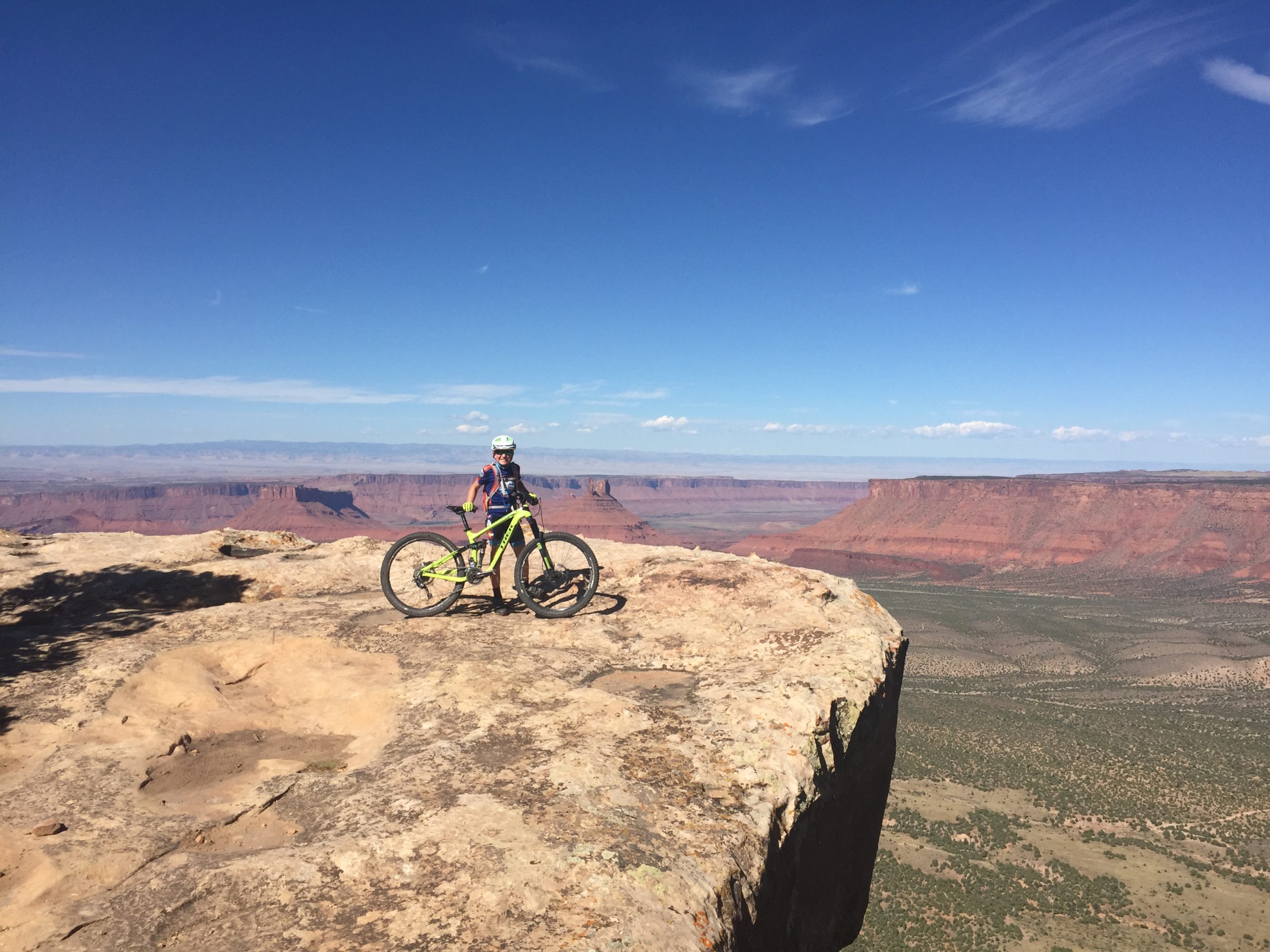
After riding a bit more in the trees the trail opened up to the start of Hazard County. The climb up to Hazard is short but can get steep and rocky/rutted. From Hazard you are still in the high country but you can see all the way down to Moab and the red rocks. The top of Hazard is a popular resting spot to eat and take in the scenery.
The descent off Hazard County is some of the most fun you can have on a bike. It’s non-stop descending that’s sometimes technical but not enough to slow you down.
UPS and LPS (Upper/Lower Porcupine Singletrack)
Next is a quick descent on the Kokopelli jeep trail and then UPS and LPS. UPS is not quite as technical as LPS and not as pounding or boring as Porcupine Rim. Be sure to stop at the overlooks and enjoy navigating the singletrack through the rocks. About halfway through LPS you’ll hit the Snotch. It’s first part is rideable and then the second part you’ll want to walk or scout out. You can find plenty of YouTube videos on this spot as well to plan.
Porcupine Rim or Raptor Route
Just when you start getting tired is usually around Porcupine Rim. Honestly it’s my least favorite section and I’m always looking for other options. Luckily there’s a good one now with the Raptor Route. Check out this route if you’ve done Porcupine before and/or have less experienced riders. This route offers more singletrack, faster downhill, and is more intermediate rider friendly. It’s also near Sand Flats Road if you have a mechanical, or just want to be done. Check out this route if you’ve done Porcupine before and/or have less experienced riders. This route offers more singletrack, faster downhill, and is more intermediate rider friendly. It’s also near Sand Flats Road if you have a mechanical, or just want to be done.
Porcupine Rim is mostly a technical jeep track that climbs for awhile and then starts descending back to road 128. It goes on for 11 miles, it’s long!
What Months to Ride
Ideally plan to The Whole Enchilada in late September or October. October usually has perfect desert weather, changing leaves and the snow and ice haven’t started. Late Spring into early June is also a good time but you might get dropped off a lower trailhead like Hazard.
How to Shuttle
There are plenty of mountain bike shuttle companies in Moab that offer shuttles to The Whole Enchilada. Burro Pass may not be available early or late in the season due to snow.
Check each shuttle company for times and details as they all offer slightly different drop off points and times. Also book as early as you can during October and November weekends as the shuttles will fill up.
Here’s the latest list of shuttle companies in Moab:
Have you done The Whole Enchilada in Moab? Did you take your kids? What route did you take? Leave a comment and let us know!
Great story, Jen. I totally agree about the life lessons one learns on the trail and the multitude of skills it takes navigating the terrain. Great job, Jen and Kalden. Ride on!
[…] shuttle ride. We have done Porcupine Rim from three drop off points. Burro Pass Trailhead for the Whole Enchilada (4 hours+ plus shuttle time), LPS (2-3 hours plus shuttle) or from the end of Sand Flats road (2 […]